Sabetha Ward 4 Part B, Brown County, Kansas
About
Outline

Summary
| Unique Area Identifier | 584063 |
| Name | Sabetha Ward 4 Part B |
| County | Brown County |
| State | Kansas |
| Area (square miles) | 0.04 |
| Land Area (square miles) | 0.04 |
| Water Area (square miles) | 0.00 |
| % of Land Area | 100.00 |
| % of Water Area | 0.00 |
| Latitude of the Internal Point | 39.91590650 |
| Longtitude of the Internal Point | -95.77052260 |
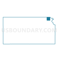
Maps

Graphs
Select a template below for downloading or customizing gragh for Sabetha Ward 4 Part B, Brown County, Kansas